The London heatwave story has taken another turn as the capital enjoys a late-September burst of summer-like weather. After an exceptionally hot summer, temperatures are rising again across London and the wider South East, prompting renewed searches about the latest forecast, another possible heatwave and what the UK weather could do next.
The important point is that warm weather is not automatically an official heatwave. London’s heatwave threshold is 28°C, and that threshold needs to be reached for at least three consecutive days before the Met Office classifies conditions as a heatwave. Current forecasts show London becoming very warm, but they do not indicate three consecutive days at the required level.
The latest forecast does, however, show a striking temperature rise for late September. Parts of south-east England could reach 27–28°C on Friday 25 September, while London is forecast to reach around 26°C.
Is London Having a Heatwave Right Now?
No official heatwave is currently confirmed for London. The capital is experiencing a notable late-September warm spell, but the latest Met Office forecast does not show temperatures remaining at or above London’s heatwave threshold for the required three consecutive days.
London’s threshold is 28°C. This means a day reaching 25°C, 26°C or even 27°C can feel very warm without technically qualifying as a heatwave. The distinction is particularly important in September, when strong sunshine and light winds can make temperatures feel more summery than the calendar suggests.
The current pattern is therefore better described as a late-season warm spell. Friday is expected to be particularly warm, before temperatures ease back towards more typical levels. The wider forecast also points towards increasingly changeable conditions as Atlantic weather systems become more influential.
London Heatwave Forecast for the Next Few Days
The immediate outlook is relatively straightforward. Thursday 24 September is expected to be fine after a chilly start, with sunny spells and a maximum of about 23°C in London and the wider South East.
Friday is the main warm-weather day. The Met Office forecasts a very warm day across the region, with London’s temperature around 26°C and some parts of south-east England potentially reaching 27–28°C. Cloud will increase later, with rain developing in some areas.
Saturday should remain comparatively dry and bright in many places, while Sunday and Monday are expected to become more changeable. This means the current warm spell is not showing the prolonged pattern normally associated with an official heatwave.
For anyone planning a trip, outdoor event or weekend activity, Friday is likely to offer the best opportunity to enjoy the late-September warmth, although forecasts can still be updated as conditions evolve.
What Is the Weather London Forecast Showing?
The latest weather London outlook shows a mixture of sunshine, cloud and mild-to-warm temperatures rather than a prolonged spell of extreme heat. The capital starts the period with a relatively cool morning before temperatures rise through the afternoon.
The sharp contrast between morning and afternoon is worth noting. A September day can begin feeling distinctly autumnal and then become surprisingly warm once sunshine develops. This is one reason London’s current conditions may feel hotter than expected despite overnight temperatures remaining relatively low.
The wider South East is likely to experience the highest temperatures. The Met Office currently expects temperatures to peak around 27–28°C in parts of south-east England on Friday, with cooler conditions elsewhere across the UK.
Beyond Friday, the forecast becomes less settled. Rain, showers and stronger winds are increasingly likely in some parts of the country, although eastern and south-eastern areas may continue to see drier intervals.
Why Is London Becoming So Warm in Late September?
The current warm spell is linked to a change in the wider atmospheric pattern. The Met Office says warmer and more humid air is moving north-eastwards, allowing temperatures to rise sharply across southern and south-eastern England.
High pressure has helped provide calmer and brighter conditions at the start of the period. Clear skies allow sunshine to warm the ground efficiently, while lighter winds can make sunny afternoons feel particularly pleasant.
However, the pattern is not expected to remain stable. A weather front is moving across parts of the UK, creating a strong contrast between the warm south-east and cooler north-west. The Met Office expects rain to develop across northern and western areas, with the boundary potentially bringing heavier rain further east.
This explains why a warm London forecast does not necessarily mean the entire UK is experiencing summer-like weather. Conditions can vary considerably over relatively short distances.
Is This a London Heatwave in September 2026?
The current London heatwave September story is better understood as an unusually warm spell rather than a confirmed official heatwave.
The reason is simple: London’s official heatwave threshold is 28°C, and the temperature must reach that level for three consecutive days. Recent London forecasts have generally remained below that threshold, although temperatures in the wider South East could approach it on Friday.
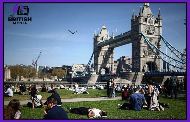
That does not make the weather insignificant. Temperatures around 25–27°C are notably warm for late September and can make London feel like summer has returned. Parks, outdoor cafés and tourist areas are likely to benefit from the sunshine, while commuters and outdoor workers may notice the warmth more strongly.
The distinction also helps readers interpret weather headlines accurately. Terms such as “mini-heatwave” may be used in media coverage to describe several warm days, but the official Met Office classification follows specific temperature and duration criteria.
When Is the Next Heatwave UK 2026?
There is currently no confirmed date for the next UK heatwave in 2026. The latest forecasts show another period of warmth in southern and eastern England, but they do not provide evidence of a nationwide heatwave developing next week.
The Met Office’s longer-range outlook for late September into early October describes a changeable pattern. Atlantic systems are expected to bring spells of rain, showers and occasional strong winds, especially across western areas. Eastern and south-eastern parts of the UK may experience longer dry periods and occasional warmth.
This means another warm spell remains possible, but it would be misleading to give a specific date for the next heatwave when the forecast does not support one.
Long-range weather predictions should also be treated differently from short-range forecasts. A possible warm signal several days or weeks ahead can change significantly as atmospheric conditions develop. The most reliable indication of an approaching heatwave comes when the forecast consistently shows temperatures reaching the local threshold for several consecutive days.
Will There Be a Heatwave UK Next Week?
The current outlook does not show a confirmed heatwave UK next week. Instead, the UK is expected to move into a more unsettled period after the late-September warmth.
The Met Office says the period from 28 September to 7 October is likely to remain changeable. Atlantic frontal systems could bring rain, showers and occasional strong winds, with western areas generally wetter and windier. Longer dry intervals are more likely towards the east and south-east.
Temperatures are nevertheless expected to be above average overall during this period. That does not mean continuous hot weather. Above-average temperatures can occur alongside cloud, rain and cooler nights.
For London, the most realistic expectation is therefore a mixture of mild or warm days and more unsettled spells rather than an immediate return to the extreme heat seen during summer.
Anyone searching for a definite date should avoid relying on individual long-range weather maps. Forecast confidence is much stronger when a potential hot spell moves into the shorter-range forecast window.
What Does BBC Weather Say About the UK Heatwave?
BBC Weather has also highlighted the rise in temperatures during the latest September warm spell, with forecasts pointing towards temperatures around 25°C in parts of the UK. The broader picture is one of a short-lived return to warmer conditions rather than an established nationwide heatwave.
This distinction is consistent with the Met Office outlook. Southern and south-eastern England are currently the areas most likely to experience the strongest warmth, while other parts of the country face cooler or more unsettled conditions.
For readers comparing BBC Weather with other forecasts, the key information is not simply the highest temperature shown on a map. It is the duration, geographical coverage and consistency of the forecast.
A 27°C forecast for one day in London is very different from three consecutive days at or above the local heatwave threshold across a wider region. That is why official heatwave declarations depend on sustained temperatures rather than one isolated hot afternoon.
How Hot Was London During Summer 2026?
The current September warmth follows one of the UK’s most remarkable summers in recent years. London experienced exceptional temperatures in both spring and summer.
Kew Gardens reached 35.1°C in May, while on 13 August 2026 the same London site recorded a provisional 38.1°C. The Met Office initially described 13 August as the fifth hottest day in UK records. Later data showed a maximum of 38.2°C at Hartpury College in Gloucestershire on the same day.
The August event was part of an exceptional period of heat. The Met Office reported that 2026 had already produced the UK’s highest number of days reaching at least 36°C, with four such days, and three days reaching at least 37°C.
Against that background, a September maximum of 25–27°C may seem less dramatic. It is still significant for the time of year, but it represents a very different level of heat from the extreme conditions experienced in August.
Why Can London Feel Hotter Than the Forecast?
The official air temperature is only one part of how hot a person feels. London’s dense urban landscape can make warm conditions particularly noticeable.
Roads, pavements, roofs and buildings absorb solar energy during the day. Areas with limited shade can therefore feel considerably warmer than leafy parks or locations with good airflow. A top-floor flat or room facing the afternoon sun can also become uncomfortable even when the outdoor temperature remains below the official heatwave threshold.
Humidity and wind matter too. A humid, still afternoon can feel more oppressive than a dry day with a breeze at the same temperature.
This is why residents should consider the conditions around them rather than focusing solely on the number shown by a weather app. A 26°C afternoon in direct sunshine can be demanding for someone working outdoors, exercising or walking around central London for several hours.
How Should Londoners Prepare for Hot Weather?
Most people can manage a warm spell comfortably by making simple adjustments to their routine. The main aim is to limit prolonged exposure to direct sunshine and avoid becoming dehydrated.
Useful steps include:
- Drink water regularly throughout the day.
- Take breaks in shaded or cooler areas.
- Avoid strenuous exercise during the warmest part of the afternoon.
- Close blinds or curtains where direct sunlight enters rooms.
- Open windows when outdoor air becomes cooler.
- Carry water when travelling around London.
- Check on older people, young children and vulnerable neighbours.
- Wear lightweight clothing during warm periods.
- Never leave children or pets in parked vehicles.
These measures become increasingly important if temperatures rise for several days or if nights remain unusually warm.
A single warm afternoon is usually manageable for most people, but prolonged heat can place greater strain on the body and make homes increasingly uncomfortable.
Could London Get Another Heatwave Before October?
Another warm spell cannot be ruled out, but the latest evidence does not confirm another official London heatwave before October.
The Met Office currently expects temperatures to fall back closer to average after Friday’s warmth, although the wider longer-range forecast keeps the possibility of further mild or warm periods alive. Eastern and south-eastern areas have a greater chance of longer dry spells than western parts of the country.
There is also a possibility of what is commonly called an Indian summer if a period of settled, warm weather develops after cooler autumn conditions have begun. The term refers to a spell of warm, calm autumn weather and should not be confused with an official heatwave.
For now, the evidence supports a mixed autumn outlook rather than a clear second wave of extreme heat. London could still experience sunny and warm days, but there is no reliable basis for predicting a particular future heatwave date.
What Will London Weather Be Like in Early October?
The early October outlook currently favours changeable conditions. The Met Office expects Atlantic weather systems to bring periods of rain, showers and occasionally stronger winds, particularly across western parts of the UK.
London and the South East could fare differently, with longer drier intervals more likely in the east and south-east. The Met Office also expects temperatures to be above average overall during the period from late September into early October.
This does not mean London will remain hot every day. Autumn weather can change rapidly, with warm afternoons followed by chilly nights, rain or strong winds.
For people planning events or travel, the best strategy is therefore flexibility. Check the forecast close to the date, particularly if your plans depend on dry or sunny weather.
The broader outlook suggests that summer-like conditions have not disappeared completely, but the UK’s weather is transitioning towards a more typical autumn pattern.
Is It Worth Enjoying London’s Late-September Warm Spell?
For most people, yes, a warm September spell can provide an excellent opportunity to enjoy London outdoors. Temperatures in the mid-20s are considerably easier to manage than the extreme heat experienced during August.
The capital’s parks, walking routes, outdoor cafés and open-air attractions can be particularly appealing in sunny weather. Visitors can also benefit from longer periods of daylight compared with the deeper autumn months.
The main consideration is timing. Outdoor activities are usually more comfortable when planned around the warmest part of the day, particularly for people who are sensitive to heat.
It is also worth remembering that the weather can change quickly. The current forecast already indicates increasing cloud and rain around the transition from the warm spell to more unsettled conditions.
So, the current warmth is worth enjoying, but it should be treated as a late-season opportunity rather than evidence that summer has returned permanently.
ALSO READ:Romesh Ranganathan Wife Leesa and Their Life Away From Fame
FAQs
Is London having a heatwave in September 2026?
London is experiencing unusually warm September weather, but the latest forecast does not confirm an official heatwave. London’s threshold is 28°C, and that level must be reached for three consecutive days. Current forecasts do not show that sustained pattern.
What is the London heatwave forecast for Friday?
Friday 25 September is expected to be the warmest day of the immediate period. The Met Office forecasts around 26°C in London, while some parts of south-east England could reach 27–28°C.
When is the next heatwave UK 2026?
There is currently no confirmed date for the next UK heatwave. Further warm spells are possible, especially in southern and eastern areas, but the longer-range forecast is changeable rather than showing a definite nationwide heatwave.
Will there be a UK heatwave next week?
The current forecast does not indicate a confirmed UK-wide heatwave next week. The period from late September into early October is expected to be changeable, with rain and showers more likely in western areas and longer drier periods possible in the east and south-east.
What does BBC Weather say about the current warmth?
BBC Weather has reported a rise towards the mid-20s during the September warm spell. The wider pattern is consistent with a short-lived period of warmer weather rather than a confirmed nationwide heatwave.
Conclusion
The latest London heatwave forecast shows another burst of summer-like weather arriving at the end of September, but the evidence does not currently support calling it an official heatwave. London is expected to become very warm, with around 26°C forecast on Friday 25 September, while parts of south-east England could reach 27–28°C.
The bigger story is the contrast with the exceptional heat already recorded in 2026. Kew Gardens reached 35.1°C in May and 38.1°C in August, demonstrating how extreme this year’s summer became.
Looking ahead, another warm spell remains possible, particularly across southern and eastern England, but there is no confirmed date for the next UK heatwave. The forecast increasingly points towards changeable autumn weather, with rain, showers and wind affecting parts of the country while London may still enjoy occasional mild and sunny periods.
For readers, the most useful approach is to distinguish warm weather from an official heatwave, follow updated forecasts and make the most of London’s late-September sunshine while it lasts.